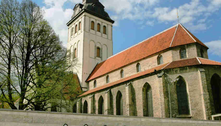
Niguliste Church

Flickr, Kaoloon
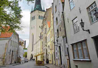
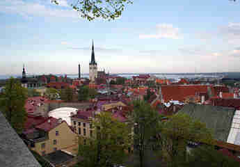
St. Nicholas Church, or Niguliste Church (Est. Niguliste kirik), is a former Lutheran church whose building now houses a museum-concert hall. The church building is located in Tallinn's Old Town. This church, named after the patron saint of all seafarers, St. Nicholas, was founded by German merchants in the 13th century. The Niguliste Museum is one of the four branches of the Art Museum of Estonia.Part of the German settlers from the island of Gotland settled southwest of Town Hall Square in 1230; this area was connected to Toompea via Pikk Jalg. A spacious site on the eastern side of today's Rataskaevu Street was chosen for construction, and by the end of the 13th century the building had been erected on its present site as a three-aisled hall church with four bays. Its appearance at the time differed significantly from the modern one. For example, there was no large western tower, whose construction required considerable expense and began only in the second half of the 14th century.
Short Leg Street

Flickr, mikkohaarala
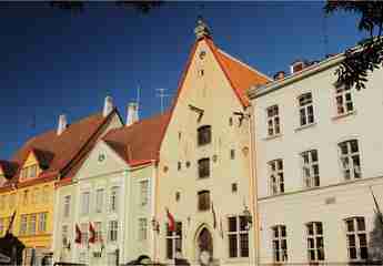
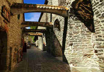
Lühike jalg (Est. Lühike jalg — Short Leg) is a pedestrian street in Tallinn's Old Town connecting Rataskaevu and Rüütli streets with Pikk Jalg. Lühike jalg also leads to the Danish King's Garden in the Upper Town. Thus, “Short Leg” links the upper, knightly-noble part of the city with the lower, merchant-burgher part.Lühike jalg is first mentioned in 1353 under the Latin name brevis mons ('short hill'), then in 1371 as: Lat. parvus mons ('small hill'). In archival documents written in Latin, the phrase Lat. descensus montis ad mare ('the slope of the hill toward the sea') also appears.From 1428, the Low Saxon name korter berg (“short hill”) is known. From 1500 — korter dombergh (“short cathedral hill”).[1]The Estonian-language name of the street became established thanks to Anton thor Helle (1732) as lühhike jalg (he gives the German equivalent as der kurtze Dohmberg, “short cathedral hill”).
Did you know that besides ready-made walking routes, we also have an audio guide to Tallinn? ;)
Danish King's Garden

Flickr, Kwong Yee Cheng
The Danish King's Garden (Est. Taani kuninga aed) is a site in the Upper Town of Tallinn, the capital of Estonia, and is a continuation of Lühike jalg Street.From the garden there is a view of the city, Niguliste Church, and medieval buildings. The northern side of the garden is bordered by part of the fortress wall with the Maiden, Kiek in de Kök, and Talli towers.From the Upper Town, the garden can be reached by a passage from the southeastern side of Alexander Nevsky Cathedral; from the lower town, the garden is reached via Lühike jalg Street and a staircase from Rüütli Street.In 1219, under the pretext of helping German colonists in the Baltics and with the blessing of the Pope, the army of Danish king Valdemar II, later nicknamed the Victorious, landed near Kolyvan (Dan. Lyndanisse) and, having seized the hillfort, encamped near Toompea Hill.On June 15, 1219, Estonian detachments attacked the Danish army led by the king and bishops. The attack of the Estonians was so unexpected that part of the Danish troops began to retreat.
Kiek in de Kök Tower

Flickr, tourism.tallinn.ee
Kiek in de Kök (Kiek in de Kök, Lower German for "Peek into the kitchen") is an old (German) name for towers, mainly those that were part of the city's fortification system. They got their name because the inhabitants of the tower could literally see what was being cooked in the kitchens of nearby houses.During the time of the Hanseatic League and the Teutonic Order, towers outside modern Germany also received this name, for example in Gdansk (Danzig) and Tallinn.The tower located in Tallinn is an artillery tower built in 1475. It is 38 meters high and has walls 4 meters thick. Cannonballs dated 1577 are still embedded in the outer walls.Restoration work in the 20th century returned the tower and the surrounding area to their original appearance. The tower now operates as a museum and photo gallery.

Flickr, Jungle_Boy
In 1561, Reval was captured by the Swedes. In those days the city was a very vulnerable target, and therefore the rulers who came to these lands decided to strengthen it by building earthen ramparts. Thus, by 1710 three bastions had been built in Reval: Skoone, Ingermanland, and Swedish. However, after the Northern War lost to the Russians, these fortifications were never again used for their intended purpose.
One of the most outstanding bastions preserved to this day is the Swedish Bastion. It is located on the southern side of the Old Town and is a pentagonal earthen rampart. On the outside it is reinforced with massive stone walls, and inside it are underground labyrinths through which soldiers once moved unnoticed by the enemy, carrying weapons and ammunition. Today these underground passages house a historical museum, which can be entered through Kiek in de Kök Tower.
Freedom Square

Flickr, tarmo888
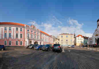
Freedom Square (Est. Vabaduse väljak, formerly Victory, Haymarket, Petrovskaya) is a city square in central Tallinn.The main landmark is the recently erected (2009) Victory Monument in the War of Independence of 1918—1920.Coordinates: 59°26′01.52″ N 24°44′38.88″ E / 59.433756° N 24.744135° E (G) (O)59.433756, 24.744135